1. The Outer Frontier of the Archipelago: Sivriada (Oxia)
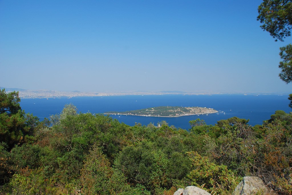
Lying approximately 6.5 nautical miles west of Sedef Island and 1.5 nautical miles northwest of Yassıada, Sivriada (ancient Greek: Oxia, meaning "Sharp" or "Pointed Island") represents the wildest, most untamed outpost of Istanbul's maritime realm. While the main Princes' Islands feature gentle rolling pine hills and populated bays, Sivriada is a solitary, pyramid-like monolith of grey granite and volcanic limestone that erupts vertically from the seafloor to an elevation of 90 meters (295 feet).
Covering an area of merely 0.05 square kilometers, the island has no sandy beaches, no permanent human inhabitants, and no municipal ferry connections. To approach Sivriada by sailboat is to witness nature in its rawest Marmara form: sheer vertical cliffs stained with sea salt, echoing with the shrieks of thousands of nesting yellow-legged gulls, and battered by the open swells of the southern sea.
2. Byzantine Monasteries, Granitic Quarries & The Imperial Seawalls
Despite its forbidding appearance, Sivriada possesses a rich archaeological history. In the 9th and 10th centuries, Byzantine emperors utilized the island as both an imperial penal monastery and a premier stone quarry:
- Monastery of Saint Michael: Founded by 9th-century monks, this remote monastic citadel crowned the island's upper eastern plateau. Its surviving ruins include brick barrel-vaulted chapels, carved stone capitals, and subterranean cisterns designed to capture winter rainwater. Several deposed Byzantine clerics and political exiles were interned here during theological disputes in Constantinople.
- Imperial Stone Quarries: The durable, dense grey granite of Sivriada was prized across the Eastern Roman Empire. Huge blocks were quarried directly from the cliff faces, rolled down wooden skids to the waterline, and hauled by heavy barges to Constantinople to build the defensive sea walls along the Sea of Marmara, the harbor docks of Eleutherios, and the foundational piers of imperial palaces.
3. The 1910 Canine Tragedy of Hayırsızada
In the cultural memory of Istanbul, Sivriada carries a sorrowful name: Hayırsızada (The Ominous or Unblessed Island). This moniker stems from the tragic events of June 1910.
As part of an aggressive modernization and sanitation campaign preceding the fall of the Ottoman Empire, the municipal authorities of Istanbul resolved to clear the historic streets of the city's beloved stray dog population. Over the course of several weeks, an estimated 80,000 street dogs were rounded up across Pera, Galata, Eminönü, and Üsküdar using iron nets, loaded onto barges, and dumped onto the barren, waterless rock of Sivriada.
With no natural freshwater springs and no vegetation to provide shade from the blistering summer sun, the animals perished over the ensuing weeks. For nearly a month, mainland residents living along the Asian shores of Bostancı and Kadıköy could hear the mournful howls carrying across the water. Shortly thereafter, Istanbul suffered a series of devastating urban fires, political turmoil, and an earthquake, which many superstitious citizens attributed to divine retribution for the cruelty on Hayırsızada. Today, animal welfare organizations and yacht skippers maintain a bronze commemorative memorial plaque on the island's eastern cove in remembrance of the victims.
4. Scuba Diving & Underwater Marine Heritage
For certified scuba divers, Sivriada and neighboring Tavşanadası represent the crown jewels of northern Marmara diving. Because these islands are far removed from municipal sewer outfalls and urban shipping channels, underwater visibility frequently reaches 15 to 25 meters during the summer months:
- Red Gorgonian Forests (Paramuricea clavata): Beginning at a depth of 25 meters along Sivriada's southern submerged drop-offs, divers encounter magnificent vertical walls covered in vibrant red and yellow gorgonian sea fans—a rare Mediterranean coral community that thrives in the rich, plankton-bearing currents flowing between the Marmara and the Black Sea.
- Ancient Roman Amphora Shipwrecks: Over the centuries, treacherous sudden windstorms drove numerous Byzantine and Roman merchant vessels into the jagged submerged reefs of Sivriada. Divers can observe scattered fields of terracotta wine and olive oil amphora necks resting in 30 to 40 meters of water.
- Pelagic Marine Life: Divers frequently encounter schools of Atlantic bonito (palamut), bluefish (lüfer), sea bream, large groupers, octopus, and occasionally playful pods of harbour porpoises and common dolphins navigating the channel.
5. Tavşanadası (Neandros) & Kaşıkadası (Spoon Island)
Two other satellite islets complete the outer archipelago circle:
Tavşanadası (Neandros)
Resting approximately 1 nautical mile directly south of Sedef Island, Tavşanadası (ancient Greek: Neandros, meaning "New Man Island") is a low, flat limestone reef covering 0.04 square kilometers. Uninhabited by humans, the island was named for its thriving population of wild hares and rabbits originally introduced by Byzantine hermits. Today, it is an officially protected wildlife sanctuary where thousands of migratory seabirds—including Mediterranean shags and Audouin's gulls—build their nests. The shallow rocky reefs extending south from Tavşanadası are a favorite anchorage for sport fishermen targeting sea bass.
Kaşıkadası (Spoon Island)
Positioned in the sheltered channel between Burgazada and Heybeliada, Kaşıkadası (ancient Greek: Pita) derives its name from its distinctive topography: an elongated, slender promontory connected to a rounded hill that perfectly resembles an upturned Turkish silver spoon. Measuring just 0.008 square kilometers, Kaşıkadası is entirely private property, owned by the Danon family. It contains a private residence, landscaped gardens, a private boat pier, and dense umbrella pine groves, strictly off-limits to uninvited landings but admired by passing yachts and kayakers.
Book a Private Yacht Expedition to Sivriada & Tavşanadası
Experience the rugged, untouched outer islets of the Sea of Marmara. Charter a private sailing yacht or motor cruiser equipped with snorkeling gear to explore the dramatic granite cliffs and sea caves.
6. Nautical Navigation Tips for Visiting the Satellites
If you plan to navigate to Sivriada or Tavşanadası aboard a private yacht or charter vessel, keep these captain's rules at the helm:
- Watch for Submerged Reefs: The southern and western tips of both Sivriada and Tavşanadası feature jagged submerged rocky shoals that extend up to 100 meters offshore. Always maintain a minimum 150-meter safety clearance unless using an accurate sonar depth sounder.
- Anchorage Conditions: Sivriada's only viable anchorage is the small cove on its eastern lee side, which offers good holding in 8 to 12 meters over sand and rock during northeasterly (Poyraz) winds. It is entirely exposed and dangerous during southern (Lodos) winds.
- Carry Complete Provisions: There is zero freshwater or food service on Sivriada or Tavşanadası. Pack all provisions, emergency first aid, sun protection, and plenty of water aboard your charter boat before departing.
7. Frequently Asked Questions: Sivriada & Satellites
Sivriada has no regular commercial passenger ferry service or inhabited town infrastructure. It is visited exclusively by private yachts, chartered fishing boats, scuba diving clubs, and rock-climbing expeditions that land along its sheltered eastern cove during calm sea conditions.
In June 1910, the Ottoman municipal government exiled an estimated 80,000 stray street dogs from Istanbul to the barren, waterless cliffs of Sivriada as part of an urban modernization campaign. With no food or fresh water, the animals perished, earning the island the tragic popular name Hayırsızada (The Ominous Island). Today, a bronze memorial commemorates this poignant chapter.
Sivriada sits at the junction of deep underwater currents in the Marmara Sea. Its steep drop-offs feature vibrant red gorgonian sea fans, dense marine life, and ancient Roman amphora wreck sites dating from the 4th to 6th centuries AD.
Tavşanadası (Neandros) is a small, uninhabited limestone outcrop south of Sedef Island, serving as a bird nesting sanctuary and world-class scuba diving spot. Kaşıkadası (Spoon Island) is a privately owned pine-covered island located between Burgazada and Heybeliada.